Where Mobile Began: The Forgotten Site at 27 Mile Bluff
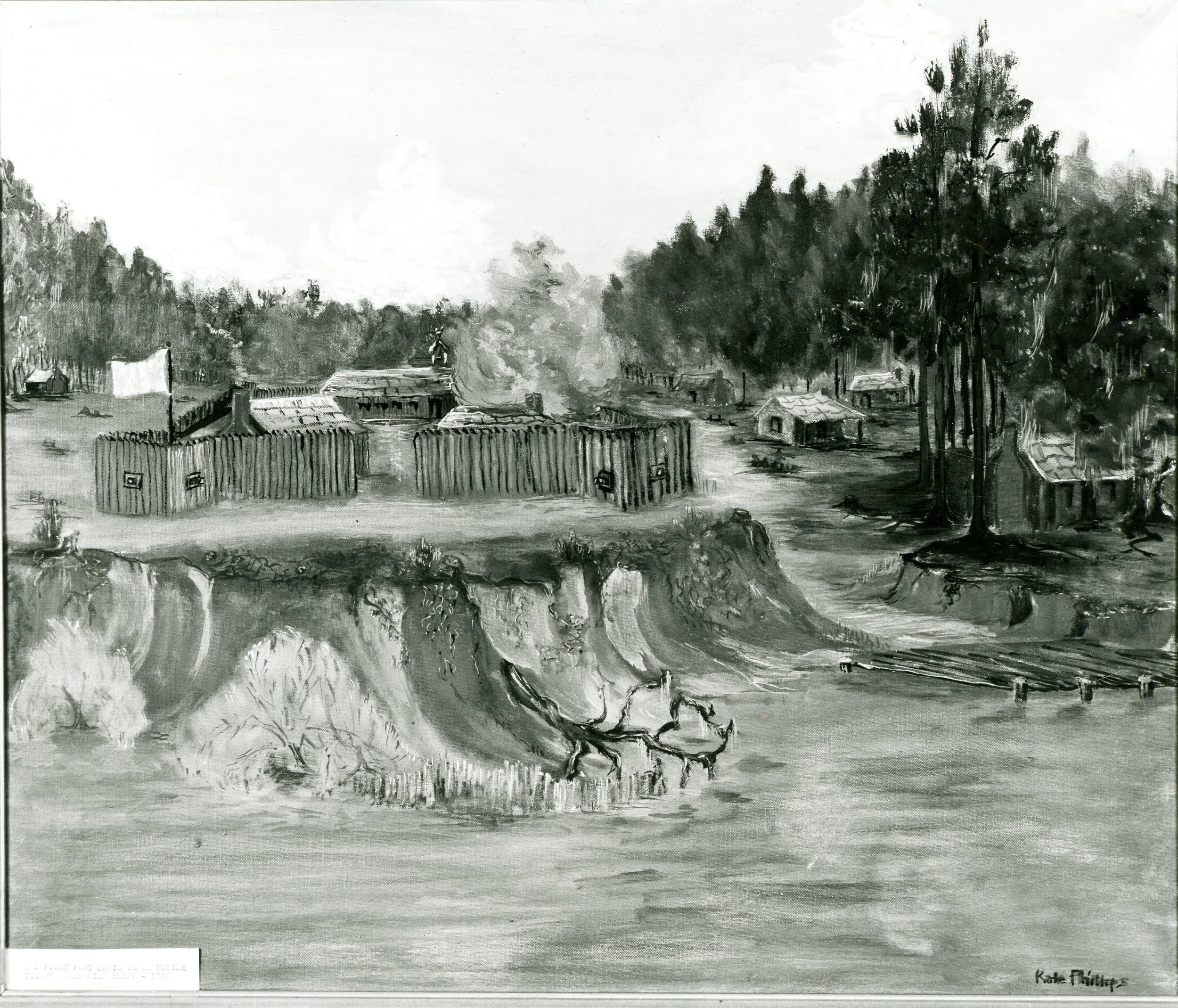
Illustration of Fort Louis de la Mobile at Twenty-Seven Mile Bluff, the original site of Mobile’s first settlement (1702–1711). The small French colonial town stood on a bluff overlooking the Mobile River and served as the first capital of French Louisiana. Image courtesy of the Historic Mobile Preservation Society Minnie Mitchell Archives.
At Twenty-Seven Mile Bluff along the Mobile River, about twenty-seven miles north of modern Mobile, Alabama, the first chapter of the city’s history began more than three centuries ago. Long before the streets of downtown Mobile were laid out, a small French colonial town stood here — a place where traders, soldiers, missionaries, and Native allies gathered along the edge of a vast wilderness. Known as Fort Louis de la Mobile, this settlement, founded in 1702, would become the first capital of French Louisiana and the birthplace of the city that later grew along Mobile Bay.
The high bluff overlooking the Mobile River also provided a natural vantage point, allowing the French to watch canoe traffic moving along one of the main waterways connecting the Gulf Coast to the interior.
Today the place is known simply as Twenty-Seven Mile Bluff. Few visitors realize that this quiet stretch of riverbank was once the administrative center of France’s vast Louisiana colony — a small but strategically important town where traders, soldiers, missionaries, and Native allies gathered at the edge of a vast wilderness.
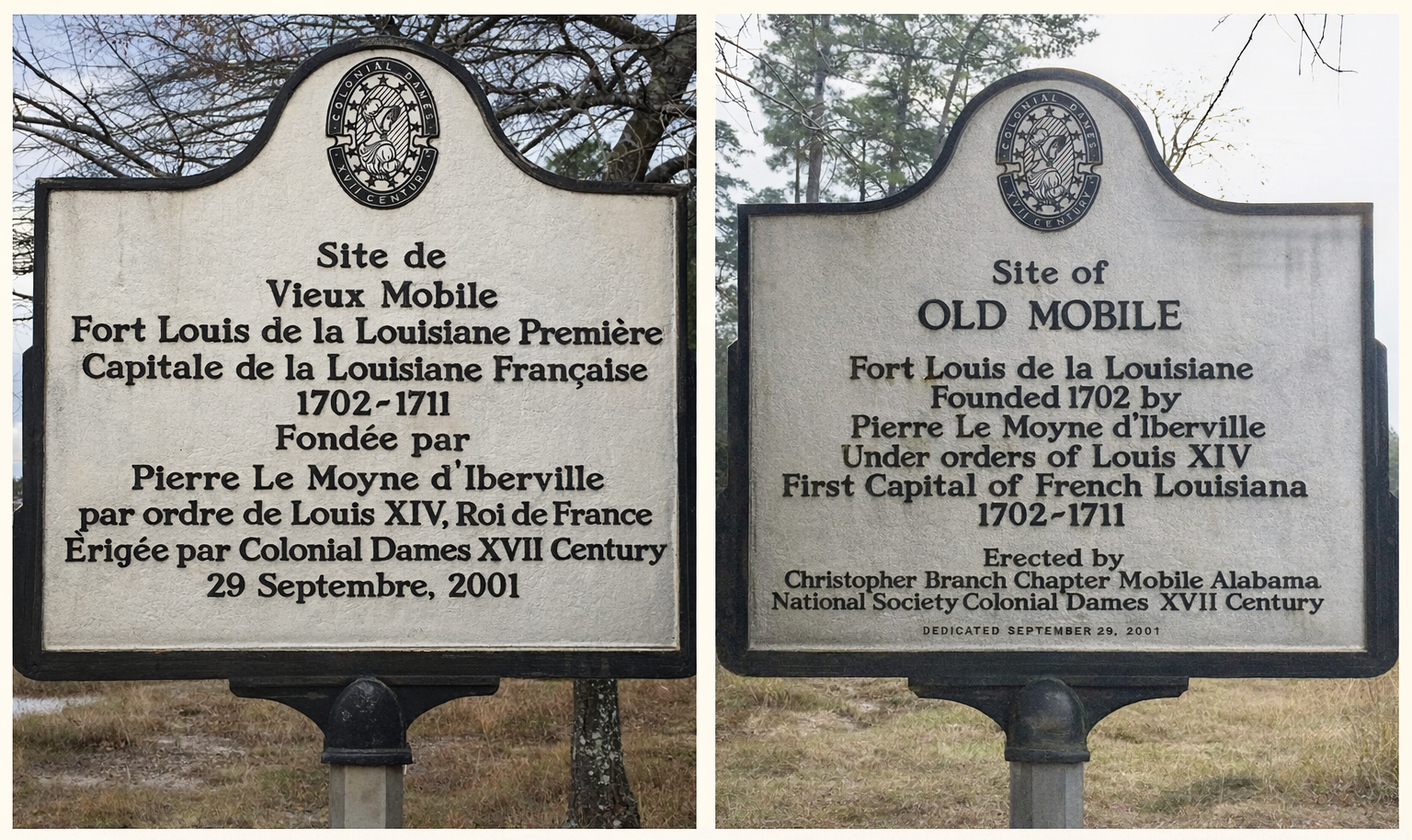
Historical marker identifying the site of Old Mobile (Fort Louis de la Mobile), the first capital of French Louisiana from 1702 to 1711. The marker was erected in 2001 by the National Society of the Colonial Dames of America XVII Century, Christopher Branch Chapter of Mobile.
The Ancient Name Behind “Mobile”

Battle of Mauvila’ illustration from “Histoire de la conquete de la Floride, ou, Relation de ce qui s'est passé dans la découverte de ce pais par Ferdinand de Soto Vol I,” Internet Archive.
Long before the French established Fort Louis in 1702, the name “Mobile” was already associated with the region.
The name comes from the Native town Mabila (also recorded as Mauvila or Mobile), described in Spanish accounts of the expedition of Hernando de Soto in 1540.
That expedition fought one of the largest battles between Europeans and Native Americans in North America at the fortified town of Mabila. Although the exact location of the town is still debated by historians, the name endured and continued to be associated with the region for generations.
A Strategic Beginning
When French explorers Pierre Le Moyne d’Iberville and Jean‑Baptiste Le Moyne de Bienville established the settlement in 1702, the location was carefully chosen.
Fort Louis sat along the Mobile River, which connected the Alabama River and Tombigbee River systems to Mobile Bay and the Gulf of Mexico.
This position gave the French access to an enormous interior trade network stretching hundreds of miles inland. Canoes arriving from Native towns carried deer skins, corn, and other goods that could be exchanged for European trade items brought from overseas.
Because of this geography, Mobile quickly became the gateway between the Gulf Coast and the interior of the Southeast.
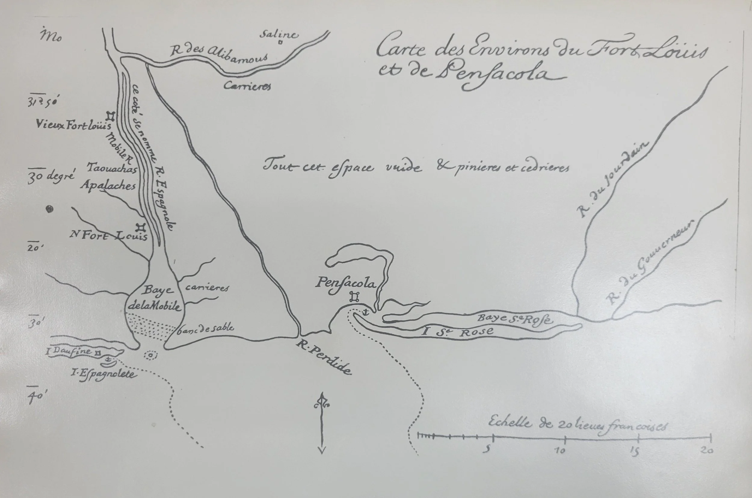
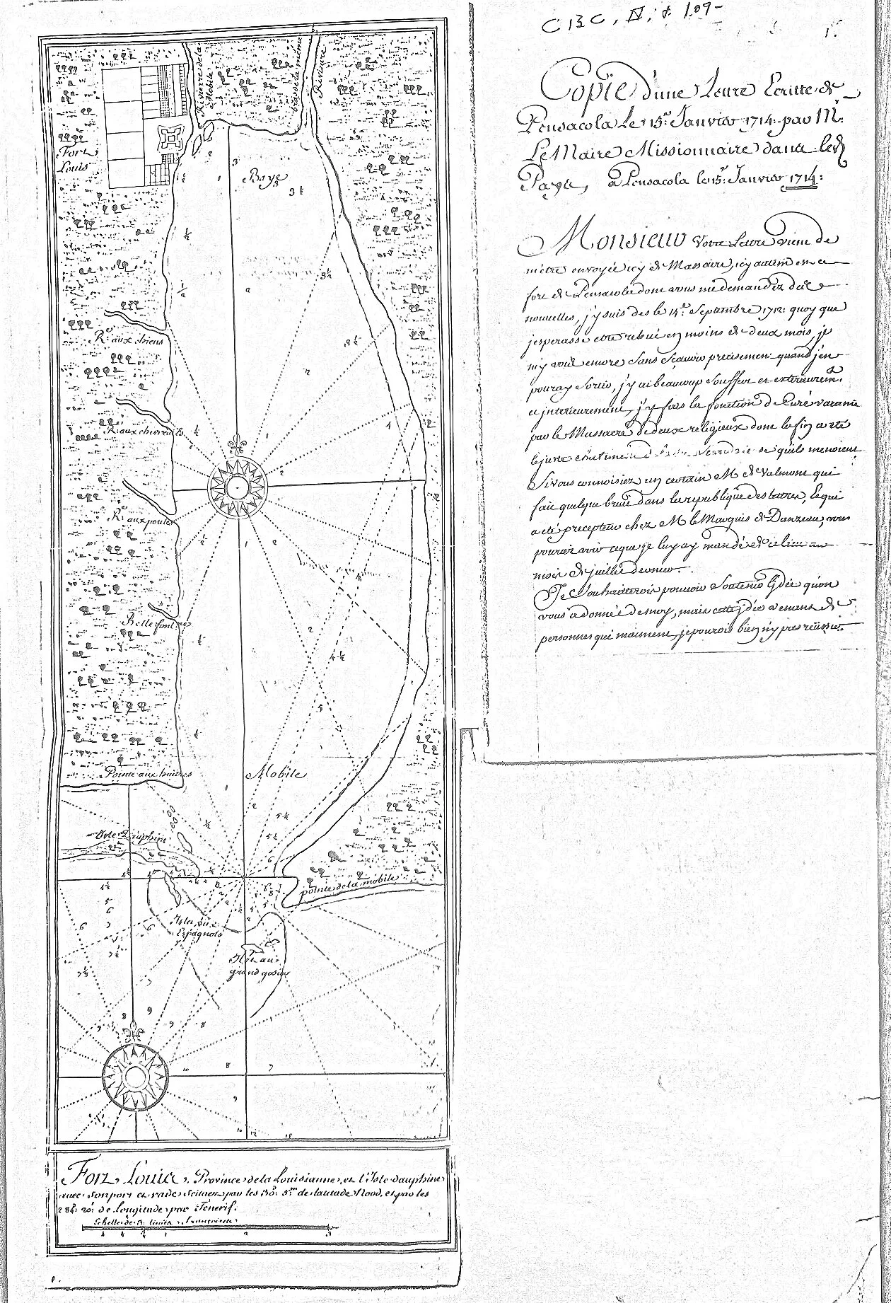
“Carte des Environs du Fort Louis et de Pensacola.” Early French map showing the region surrounding Fort Louis de la Mobile and Pensacola. Maps such as this helped French officials understand the strategic geography of the northern Gulf Coast during the early eighteenth century. The map also includes a note describing the surrounding terrain as “vast and covered with cedar thickets,” giving a glimpse of the landscape encountered by early French explorers.
A Planned Colonial Town
Although often described as a frontier outpost, early maps show that Fort Louis was carefully planned as a colonial town.
Wide streets divided the settlement into rectangular blocks. At its center stood Le Marché, the market square where trade and daily activity took place. Nearby were the governor’s residence, barracks, and the colony’s church, which stood close to the river landing where boats arrived from downstream.
Small timber houses lined the streets, and behind them lay gardens and work yards. Archaeological excavations have uncovered evidence of these homes along with artifacts that once belonged to the settlers who lived there.
Despite its importance as the capital of French Louisiana, the town itself was quite small. A census from the early eighteenth century records fewer than two hundred French inhabitants in the Mobile district.
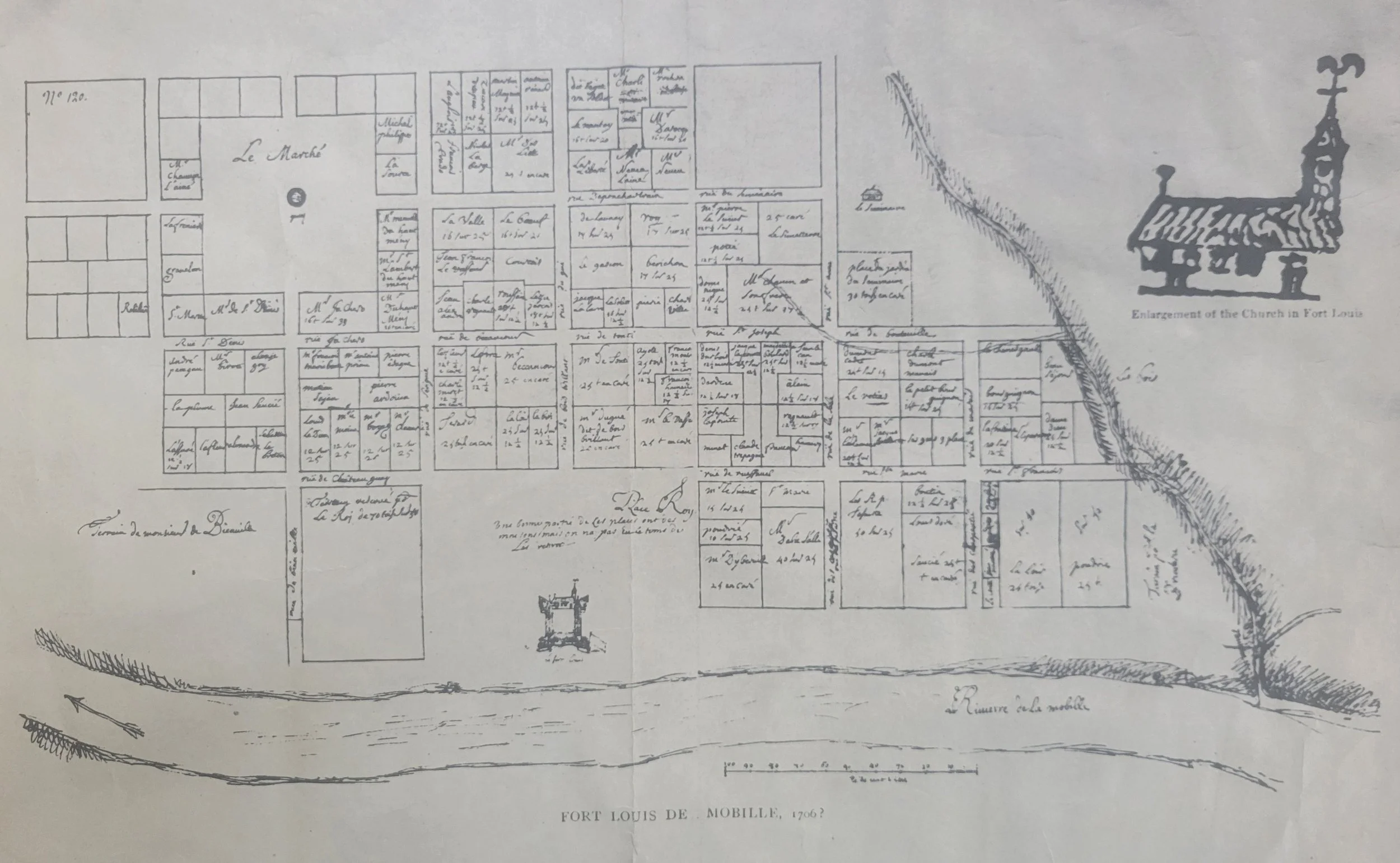
Early plan of Fort Louis de la Mobile showing the organized layout of the settlement at Twenty-Seven Mile Bluff. The town was arranged around a central market square (Le Marché), with the fort positioned along the Mobile River where supplies and travelers arrived by boat.
Interestingly, the map gives prominence to the market square rather than the fort, reflecting the colony’s primary role as a trading hub connected to Native river networks.
A Colony Dependent on Native Alliances
The survival of the colony depended heavily on partnerships with Native nations in the region.
Trade with the Choctaw and other Native communities provided food, furs, and vital alliances that helped the fragile colony survive its early years.
Glass trade beads, ceramics, and other artifacts uncovered at the site show just how active these trade networks were. Canoes arriving along the river connected the small French town to a vast Native world that had existed long before Europeans arrived.
Missionaries traveling through the region also recorded the constant movement between French settlements and Native villages along these rivers.
From a Missionary’s Letter, 1714
“We traveled by canoe through the rivers and forests of the Mobile country, visiting the villages of the natives and ministering to both the French and the Indians who live along these waters.”
— Father Antoine Davion
French missionary letter written from Pensacola, 1714
The Myth of the Flooded Site
A long-standing local story claims that Native allies convinced the French to build their settlement at Twenty-Seven Mile Bluff knowing the site would eventually flood.
While the tale has persisted for generations, contemporary French correspondence suggests otherwise. The location was chosen intentionally because it controlled a major river trade route and placed the colony near important Native trading partners.
Only after several difficult years did the French realize that flooding, disease, and supply challenges made the site impractical for a permanent settlement.

Historic map showing regional travel routes and waterways used by Native communities long before the arrival of Europeans. These routes connected the Mobile River system to other parts of the Southeast and shaped the location of early colonial settlements.
The Move Downriver
By 1711 the challenges of the river location had become impossible to ignore. The site’s distance from Mobile Bay made it difficult for supply ships arriving from France to reach the settlement easily. The colony relocated approximately twenty-seven miles downstream to the site of present-day Mobile, Alabama.
The new location offered better access to Mobile Bay and made it easier for ships arriving from France to deliver supplies.
Timber from some of the original buildings at Fort Louis was even reused in constructing the new settlement.
Though the town moved, the first chapter of Mobile’s history remained on the bluff overlooking the river.
Map showing the narrow entrance to Mobile Bay, a strategic “chokepoint” controlling access between the Gulf of Mexico and the rivers leading inland. The relocation of Mobile closer to the bay allowed the French colony easier access to maritime trade and supply routes.
From Old Mobile to Modern Mobile
When the French abandoned Fort Louis in 1711, the settlement moved approximately twenty-seven miles downriver to a new location closer to Mobile Bay. The move made it easier for ships arriving from France to unload supplies and allowed the colony to develop as a coastal port.
Today the original site of the settlement remains at Twenty-Seven Mile Bluff along the Mobile River, while the city that grew from that early colony stands along the shores of Mobile Bay.
Remembering the Site
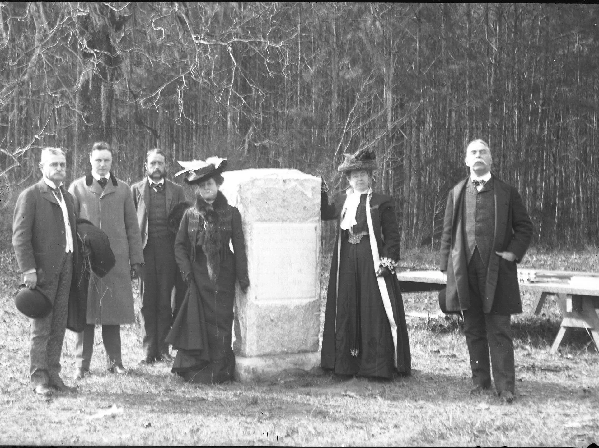
Participants at the 1902 bicentennial commemoration of Mobile gathered beside the monument erected to mark the site of Fort Louis de la Mobile at Twenty-Seven Mile Bluff. Image courtesy of the Historic Mobile Preservation Society Minnie Mitchell Archives.
In 1902, during Mobile’s bicentennial celebration, local historians traveled upriver to the bluff and erected a monument marking the birthplace of the city. Photographs from the 1902 ceremony even show benches placed beside the monument, suggesting that visitors were already expected to travel upriver to see the birthplace of Mobile. More recently, new interpretive panels have been installed to help visitors understand the significance of the location.
Rediscovering Old Mobile
For many years the exact location of the original settlement was uncertain. Archaeological work in the twentieth century helped confirm that the site at Twenty-Seven Mile Bluff was indeed the location of Fort Louis.
Excavations led by archaeologists including Gregory Waselkov uncovered artifacts and structural remains that matched early French maps of the settlement.
These discoveries allowed historians to reconstruct the layout of the town and confirm that the carefully drawn colonial plans had been remarkably accurate.
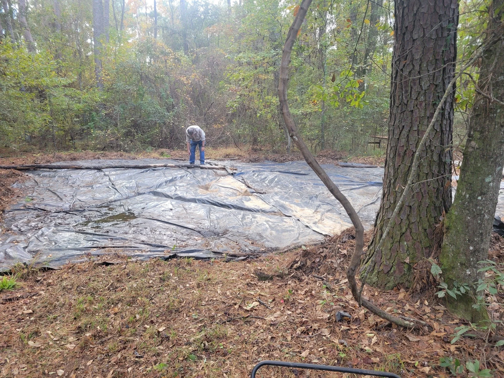
Archaeologist Gregory Waselkov examining a protected excavation area at the site of Fort Louis de la Mobile at Twenty-Seven Mile Bluff. Archaeological excavations helped confirm the location of the original 1702 settlement.
Interpreting the Site Today
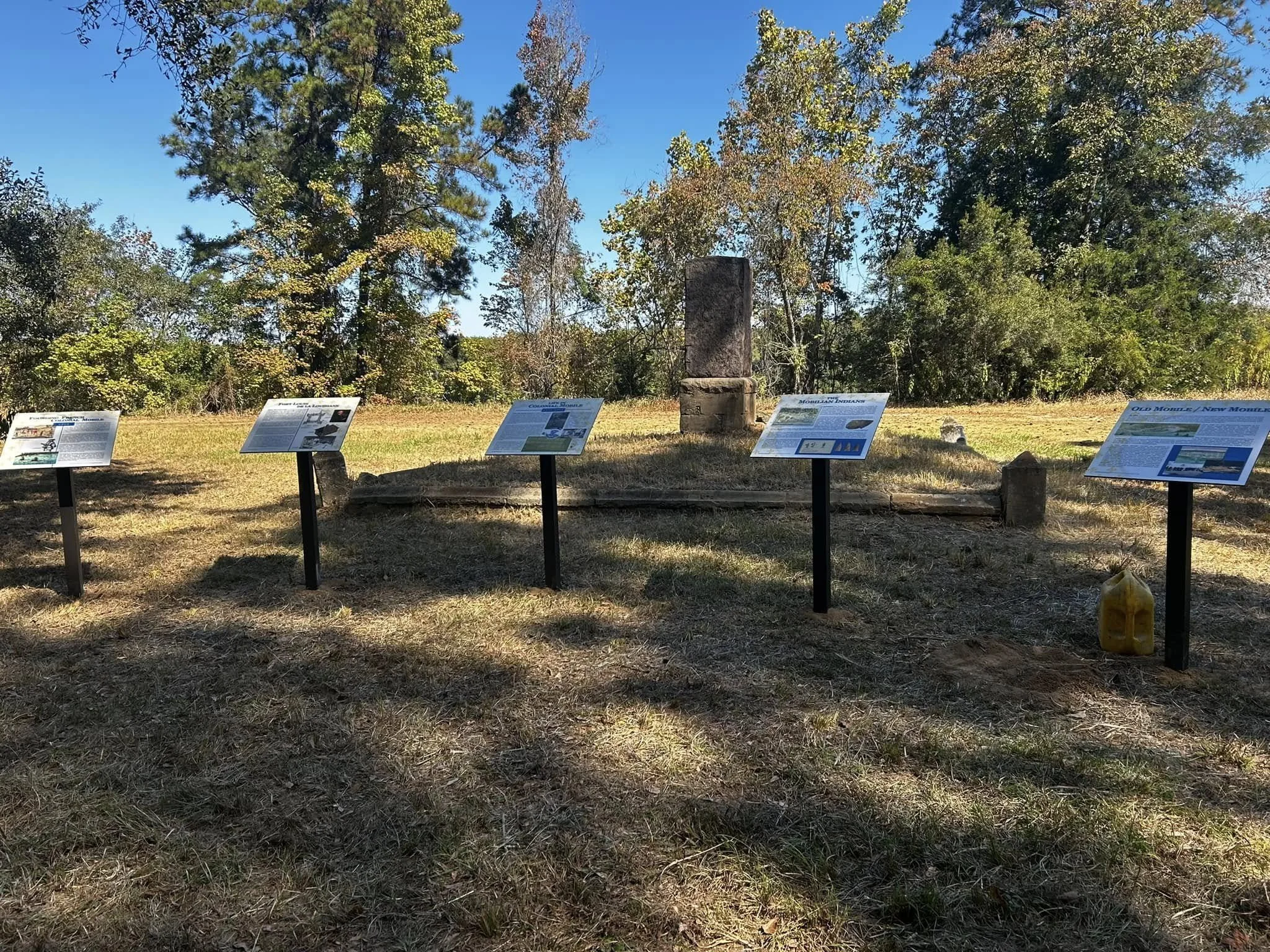
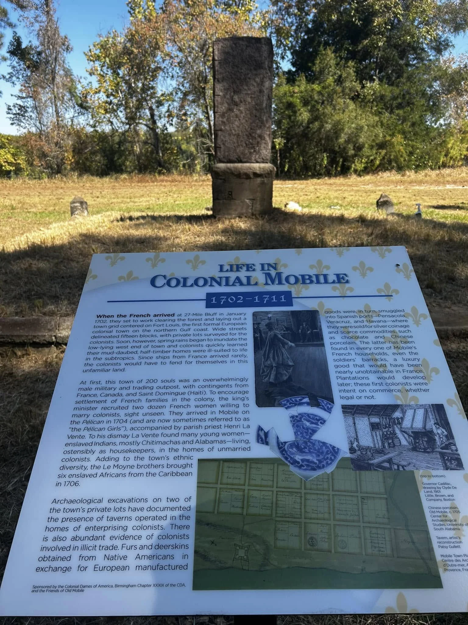
Today visitors to the Old Mobile site at Twenty-Seven Mile Bluff can learn about the early French settlement through a series of interpretive panels placed near the monument. These displays explain daily life in the colony between 1702 and 1711 and help visitors visualize the small trading town that once stood along the Mobile River. The panels were sponsored by the Colonial Dames of America—Birmingham Chapter XXXIX—and the Friends of Old Mobile.
Preserving the Site
In October 2024 and again in November 2025, volunteers gathered at the site for cleanup days, clearing vegetation and helping preserve the historic grounds. The project was later recognized with a community service award through the Tristan de Luna Chapter of the National Society Daughters of the American Revolution, honoring the volunteers who worked to protect this important piece of Gulf Coast history.
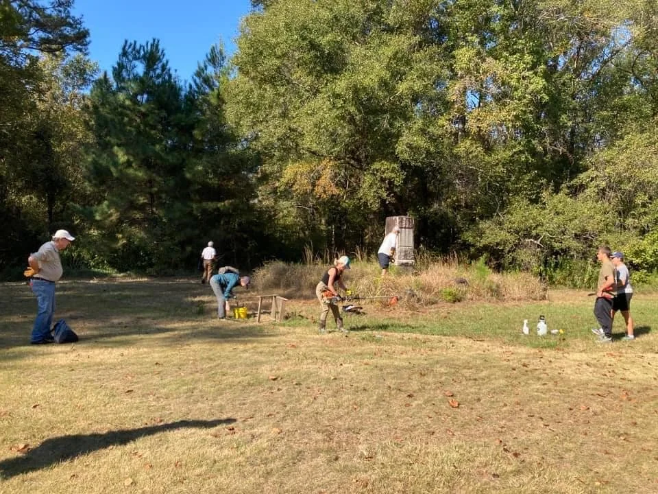
Volunteers gather at the historic site of Old Mobile during a cleanup day in October 2024. Community preservation efforts help maintain the location where Mobile’s first settlement stood.
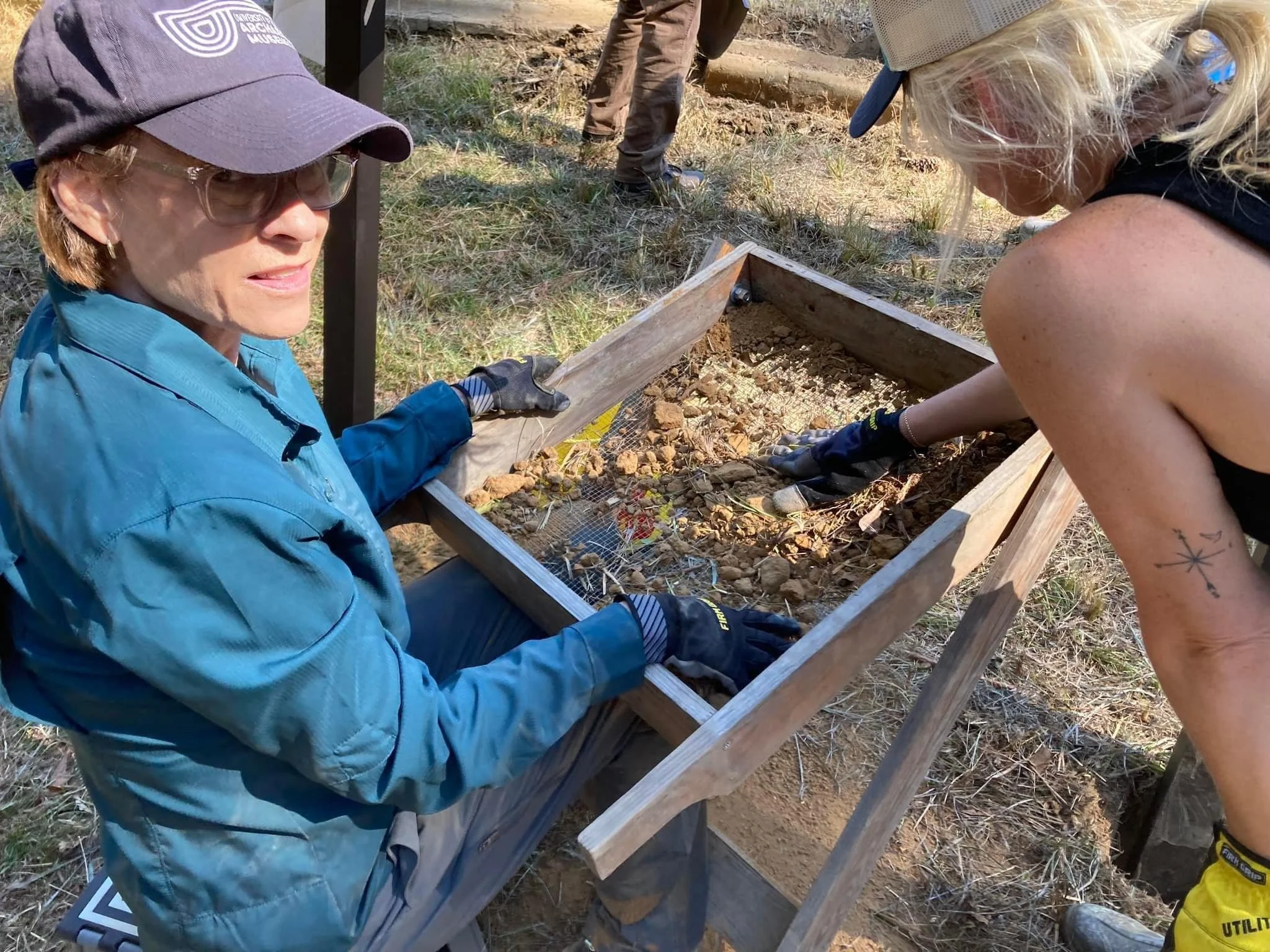
Volunteers screening soil for artifacts during preservation work at Twenty-Seven Mile Bluff. Archaeological discoveries at the site have included ceramics, trade beads, and other objects connected to the early French colony.
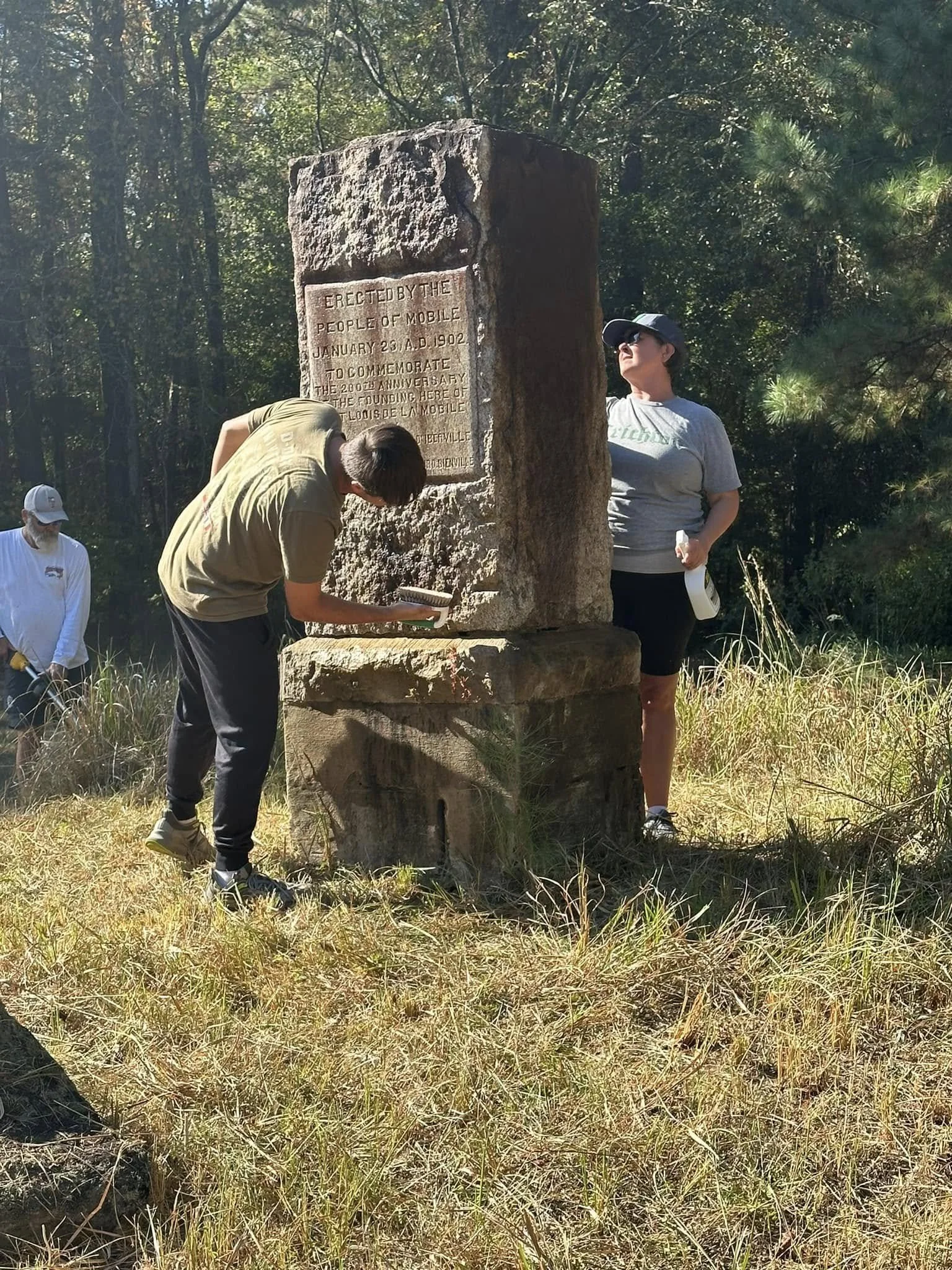
Volunteers clean the 1902 monument marking the site of Fort Louis de la Mobile during the October 2024 cleanup at Twenty-Seven Mile Bluff.
Standing at the bluff today, it takes little imagination to picture the small French town that once stood there. Looking out across the river, I found myself wondering what the scene must have been like more than three centuries ago — the market square busy with trade, the chapel bell ringing above the settlement, and canoes arriving from Native villages farther inland.
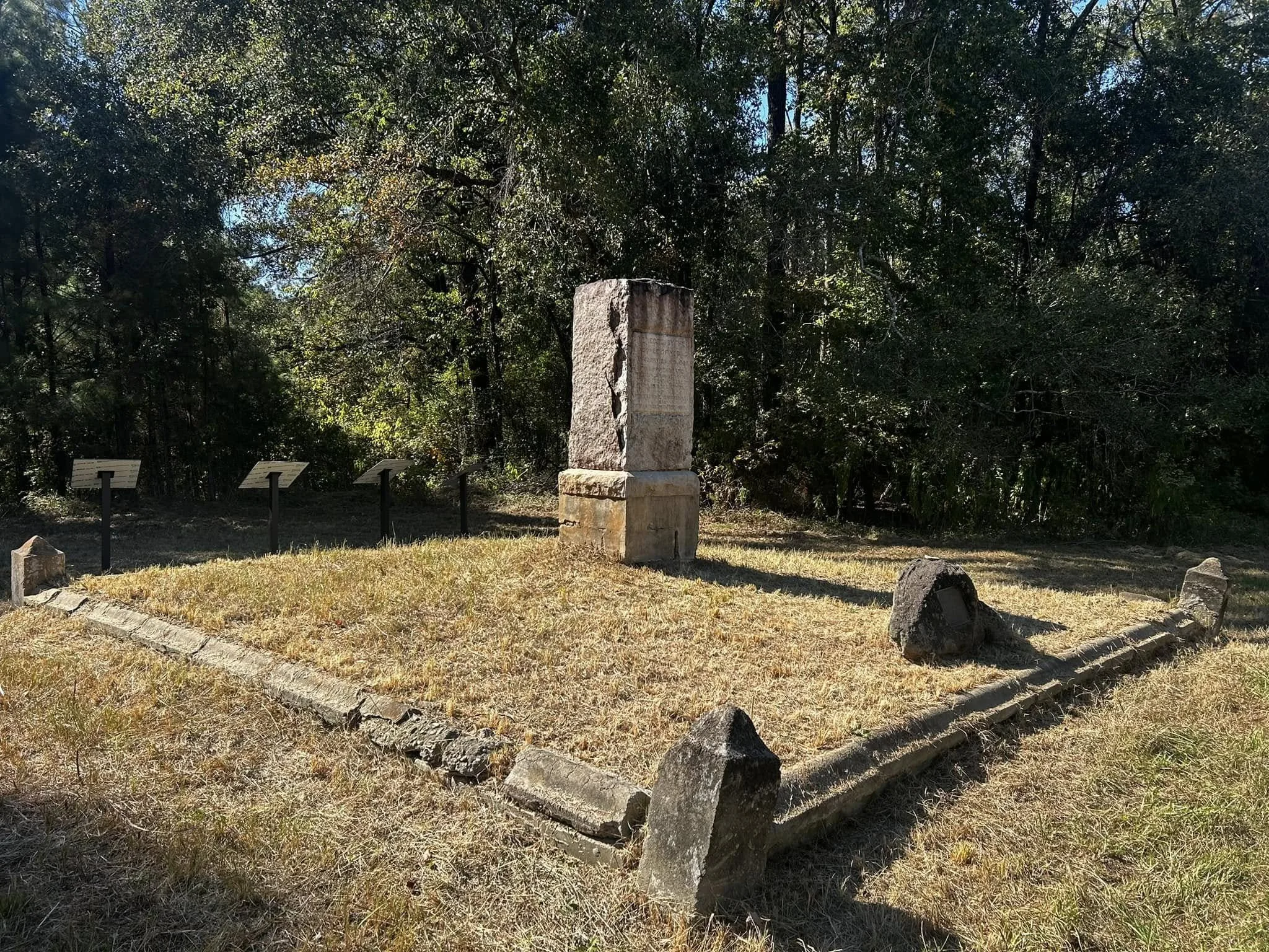
The monument marking the site of the original settlement of Mobile, as it stands today—erected during the city’s 1902 bicentennial celebration.
Today, Twenty-Seven Mile Bluff remains a quiet place along the Mobile River, marked only by a monument and a handful of interpretive signs. Yet beneath the soil lie the remains of the first European settlement that gave birth to the city of Mobile. Archaeological excavations, historic maps, and surviving letters allow us to glimpse the small French town that once stood here more than three centuries ago. Thanks to the work of archaeologists, historians, and dedicated volunteers who continue to preserve the site, the story of Old Mobile is no longer forgotten. It remains an essential chapter in Gulf Coast history — the place where the story of Mobile first began.
Sources
Bridges, Edwin C. Alabama: The Making of an American State. Tuscaloosa: University of Alabama Press.
Fortier, Alcée. A History of Louisiana.
Higginbotham, Jay. Mauvila. Mobile, Alabama: A. B. Bahr & Co., 2000.
Higginbotham, Jay. Old Mobile: Fort Louis de la Louisiane, 1702–1711.
Mobile Local History & Genealogy Library, Vertical Files, Old Mobile / Fort Louis de la Mobile.
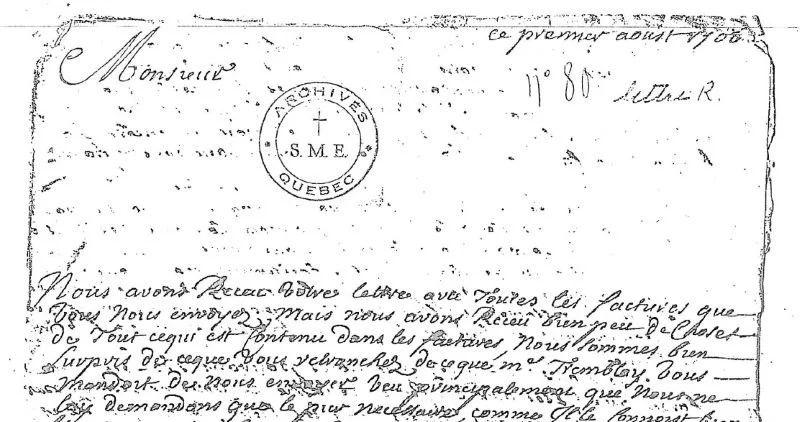
French colonial correspondence preserved in the Archives du Séminaire de Québec.
Waselkov, Gregory A. Archaeological research and site interpretation, University of South Alabama Center for Archaeological Studies.
Historical Marker Database. “Old Mobile Site.” https://www.hmdb.org